-
-
-
About Union
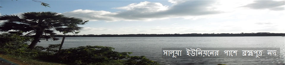
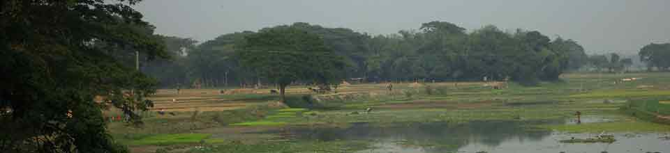
Geographical & Economic
Miscellaneous
-
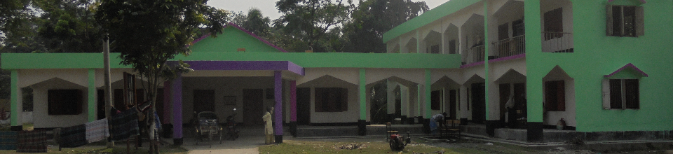
Union Parishad
Union Council
Activities of Union Council
-
Govt. Office
Agriculture
Land
Health Services
Social Service
-
Other Institutions
Educational Institutions
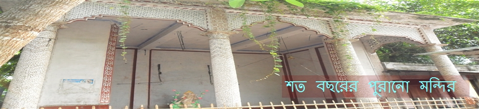
Religious Organizations
Organizations
-
Different Lists
List of Beneficiaries
Other listings
- Projects
-
Services
UDC
National E-Service
- Gallery
-
Other
Citizen Charter
Law enforcement force
Newspaper
Address of all the banks of Bangladesh
-
-
-
About Union
Geographical & Economic
Miscellaneous
-
Union Parishad
Union Council
Activities of Union Council
-
Govt. Office
Agriculture
Land
Health Services
Social Service
-
Other Institutions
Educational Institutions
Religious Organizations
Organizations
-
Different Lists
List of Beneficiaries
Other listings
- Projects
-
Services
UDC
National E-Service
-
Gallery
Photo Gallery
Video Gallery
-
Other
Citizen Charter
Law enforcement force
Newspaper
Address of all the banks of Bangladesh
Communication system
Kishoreganj district communication system with Dhaka division
Buses and trains can be made through Dhaka.
Through the railway
From Kamalapur, Airport, Tejgaon Railway Station (Rs 125 to 225) in Kishoreganj district, Bhairab Bazar, Kuliarchar, Bhagalpur, Sararchar, Kishoreganj districts are located at different railway stations. Durant (165 km)
By bus
Buses (buses of 100 to 250 taka) from different bus stations in Dhaka Division, Tongi, Airport, Gulistan, etc. are coming to different bus stations in Kishoreganj district, Bhairab Bazar, Dwari Kandi, Katiadi, Pool Ghat, Kishoreganj Battistyas.
Communication system of Saluaiyan with Kishoreganj district
At the Kishoreganj DC office, there is a lottery bus station (rickshaw rent @ 20 rupees) with a rickshaw. From the thirty bus station (60 taka rented), Dariakandi Station. From Dariyakandi station to CNG or AutoCorrect (10 to 20 taka rented) directly on the Saluayan Parishad.
Salua Union communication system with the upazila
Salaiyuan's excellent communication network with Kuliyarchar upazila. With the help of the district or the CNG, the Bajra or the Dariakandi bus station (Rent 10 to 20 taka). From CNG or Auto Joint to Bijra or Dariakandi bus station (Rent 10 to 20 taka) Saluayuan Council (about 8 km).
Pucca and raw roads inside Salua Union Details:
Raw roads
1. Dumarkanda pucca road up to the nearest boundary of Charakamalpur up to 5 kilometers
2. Crossing road from Dumarkanda's pucca bridge to the Jaira canal on the eastern side is 5 kilometers
3. Bazra Dumurakanda pucca road to the north of Shil Bazar is 3 kilometers up to Kandulia Bond house
4. From the eastern boundary of the village of Bazra, it is situated on the western side of Machimpur Bhuiyan, on the south side, 7 kilometers to the Bajra Dumarkanda pucca road.
5. Bhetuputra River Ghat From the house of Yogesh Varman, on the east, Vitigao is 6 km to the paved road of Dariyakandi Dumraakanda
6. 5km from Birkasamnagar A. Master's house to Birakasamnagar Mura Mia's house in the west north.
7. Road to Birkamishnagar Sarup Bazar's Mosque in the West 5 km to Charpigal
8. From the Central Salua Monastery to the south of South Salua, the road to the last boundary is 4 kilometers
9. 4 km to the house of Amarchand on the east side of Dumarkanda Faridpur pucca road.
10. The road from Myjapara Bhuban Chowkidar's house to the northeast canal is 3 kilometers
11. From Maijpara pucca road to Farak Mia house on the south side of Maijapara East border to Pachatia 3 km
12. The tower from the Bajra Graveyard is 2 kilometers to the south east of the Asian Highway
13. From Salua Madrasa to the east, Uttara Salua Private Primary School is up to 4 kilometer from GTG.
14. From the shore of Malkana to the South Salua Khidirpur border in the south of the southern side is 1 kilometer.
15. Dumarkanda from pucca road up to 3 km up to Durgaon Pub Para Mourjai border on the north.
Paved roads
1. 4 km from Bazra to Dumarkandanda Bazar
2. 4km from Dumraakanda to Faridpur border on the south side
3. From Dumurakanda Bazar to the east in Dariyakandi up to 5 kilometers
4. Road from Dumarkakanda Bazar up to Mujrai border on the west side 4 kilometers
5. From Durgaon Paka Mosque to the Birkasimnagar High School up to 3 km
6. From Manoharpur up to 3km towards Charakamalpur bazar in the west


Planning and Implementation: Cabinet Division, A2I, BCC, DoICT and BASIS
Technical Assistance:
![]()
Developed By: